DOD set to 'double down' on geospatial intelligence
Speakers at the GEOINT symposium talk about the value, but also the challenges, of "creating coherence out of chaos."

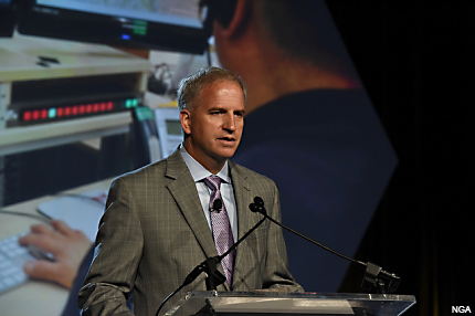
NGA Director Robert Cardillo.
The military has seen plenty of results from geospatial intelligence, from enabling the United States to attribute chemical attacks in Syria to the Assad regime, to predicting strikes by Iraqi insurgents to helping to locate Osama Bin Laden.
And officials expect GEOINT to become a bigger player in global operations, in both military and humanitarian efforts, said Robert Cardillo, director of the National Geospatial-Intelligence Agency.
Cardillo delivered one of several keynotes Tuesday at the GEOINT 2015 Symposium that, taken together, underscore the growing importance of geospatial technology in enabling both defensive and offensive operations.
In the day’s opening keynote, Deputy Secretary of Defense Robert Work said the United States is going to “double down” on GEOINT, expanding its constellations, increasing fidelity and quickening response times.
Cardillo said that NGA, which supplies imagery and other data to the Intelligence Community, is also looking to grow out. “We’ve expanded our definition of support,” he said, through international partnerships of the kind that helped coordinate the response to the Ebola crises in West Africa and the earthquake in Nepal, the latter of which involved coordination with governments and other geospatial organizations, such as Digital Globe. “Team GEOINT at its best,” Cardillo said.
Several of the day’s speakers referred to GEOINT and the analytics that goes into it as “creating coherence out of chaos.” And in many ways it works, but they do have a lot of chaos to deal with—chaos in the form of piles of unstructured data that has to be parsed for useful information.
Retired Army General Stan McChrystal, former commander of U.S. and international forces in Afghanistan, focused more on military operations but also sounded the theme about the need for unified operations and the uncertainties of getting vast amounts of information from often disparate sources. He brought up the Iran hostage crisis of 1979 and why an attempted rescue failed—because the operation was made up of a mish-mash of Navy, Marine, Air Force and Army components that weren’t used to working together. “It was an ad hoc arrangement” doing a very difficult and complex task, he said.
In dealing with intelligence, McChrystal said, there is the complicated (which is predictable) and the complex (which is not always). As an example, he mentioned the butterfly effect, a term coined by Edward Lorenz when he noticed that very small changes in the initial conditions of his weather model produced vastly different results. That led to the oft-repeated idea that a butterfly flapping its wings in one part of the world could eventually produce a hurricane in another part. But Lorenz’s real point, McChrystal said, was that the result of a small event with many variables is impossible to predict.
That’s part of the problem facing intelligence agencies and analysts as they try to make sense of the big data collected by NGA and the armed services—that, while GEOINT and other intelligence have proved useful, sometimes small indications can’t project certain outcomes. For now, NGA and the services are focusing on improving their data collection and analyses, and trying to do it in as near-real time as possible.


